We are pleased to announce that Locus GIS now seamlessly integrates with the GLRM RTK GNSS receiver from General Laser to enhance your field data collection with centimeter-level accuracy. This collaboration brings together the robust capabilities of Locus GIS and the advanced technology of the GLRM device, providing an efficient and affordable solution for geospatial professionals.
Introducing the GLRM
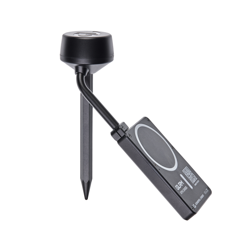
The GLRM is a compact, multi-band RTK GNSS receiver with tilt compensation that enables accurate measurements even when the unit is not perfectly level. Key features include
Comprehensive GNSS Support: Tracks all major satellite constellations for reliable global positioning data.
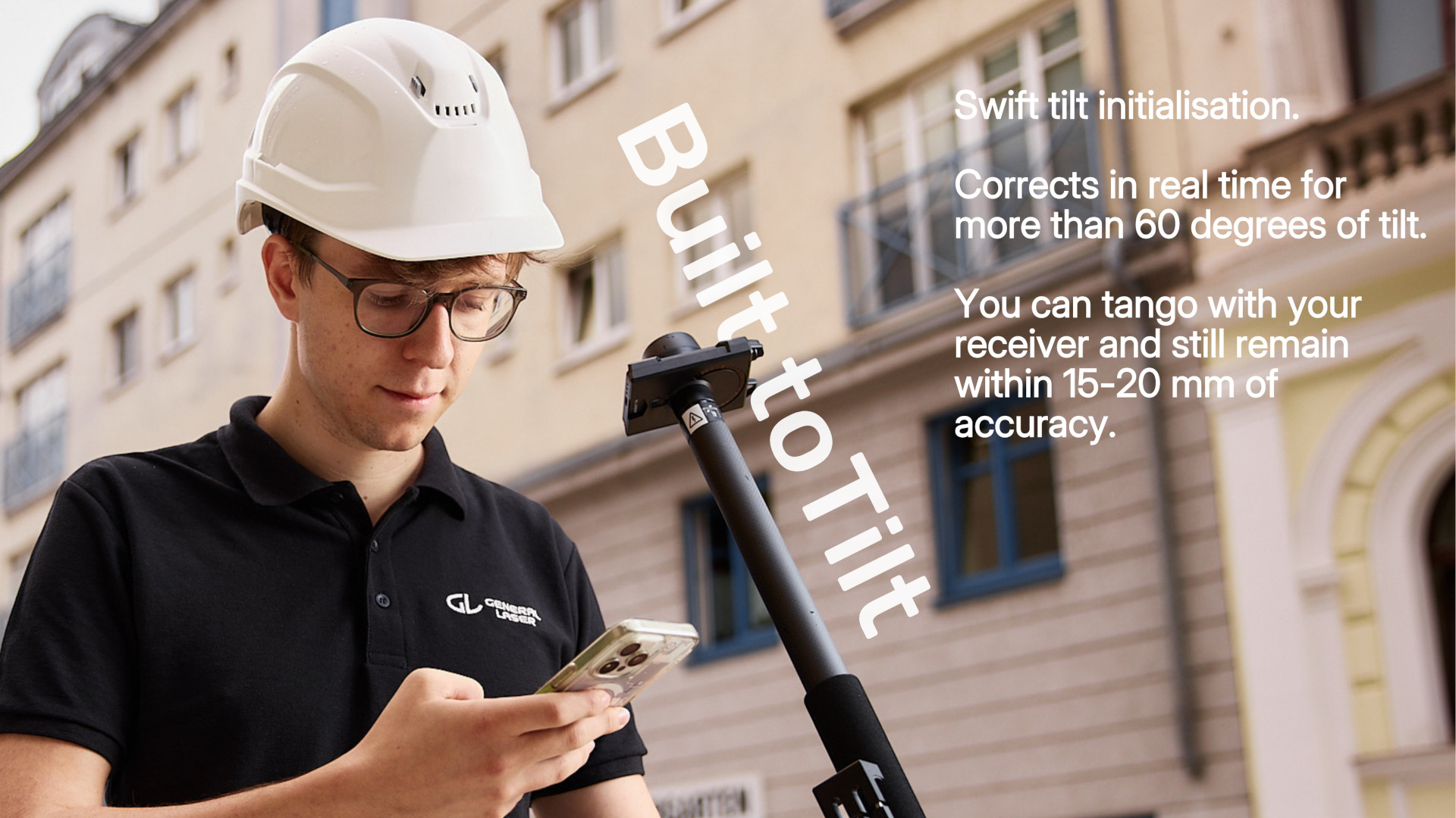
Tilt Compensation: Enables accurate measurements without the need to hold the instrument upright, increasing efficiency in the field.
Compact and lightweight design: Measuring 110 × 70 × 65 mm and weighing only 260 g (including the mast antenna), it’s designed for portability and ease of use.
Rugged construction: With an operating temperature range of -40°C to +85°C and an IP67 rating, the GLRM is built to withstand harsh environmental conditions.
Seamless Integration with Locus GIS
Integrating the GLRM with Locus GIS is easy – just add the device from the list of available devices in the GNSS Manager.
Wireless Connectivity: The GLRM connects to your mobile device via Bluetooth Low Energy (BLE), ensuring a stable and energy-efficient connection..
Real-time data streaming: Receive highly accurate positioning data directly into the Locus GIS application, facilitating real-time data collection and analysis.
Affordable precision for geospatial professionals
GLRM provides an economical solution for professionals seeking high precision GNSS capabilities without compromising quality. Its affordability, combined with the comprehensive features of Locus GIS, makes it an ideal choice for surveyors, environmental scientists, and GIS specialists.
In the ever-evolving world of geospatial technology, precision is paramount. That’s why we’d like to highlight the seamless integration of Locus GIS with ArduSimple devices, bringing professional-grade GNSS accuracy to your mobile surveying workflow.
ArduSimple, a company based in Andorra, offers affordable and ready-to-use GPS/GNSS RTK receivers that are changing the game for land surveyors and GIS professionals. These devices are tailored for both professional users and individuals, delivering traditional survey performance at a fraction of the cost.
For more information about ArduSimple and their range of products, visit their website at https://www.ardusimple.com/.
Why ArduSimple?
ArduSimple’s receivers leverage multi-constellation GNSS technology, tapping into GPS, GLONASS, Galileo, and BeiDou systems. This multi-system approach ensures robust positioning even in challenging environments. When paired with Locus GIS, you’re looking at centimeter-level accuracy that rivals traditional survey-grade equipment.
Together with ArduSimple experts, we’ve thoroughly tested several ArduSimple products and can confirm their compatibility with Locus GIS:
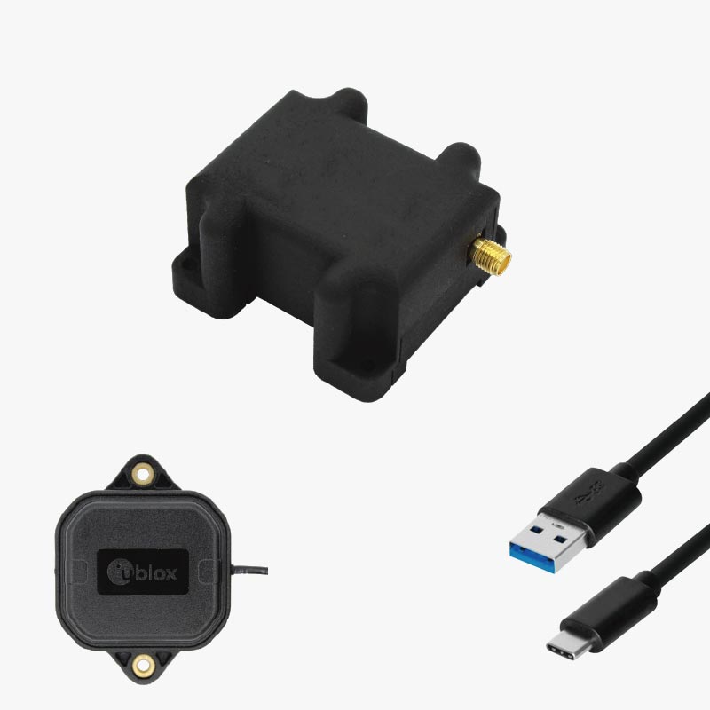
RTK Calibrated Surveyor Kit: This comprehensive GNSS/RTK Calibrated Kit provides everything you need to start using your smartphone for licensed surveyor tasks and cadastre work.
RTK Handheld Surveyor Kit: Perfect for those who need to use their mobile phone for surveying tasks with centimeter-level accuracy.
RTK Portable Bluetooth Kit: A portable ZED-F9P RTK receiver and antenna with USB and Bluetooth, all housed in a plastic case. It comes pre-configured, allowing you to use it right out of the box.
These kits provide everything you need to start your surveyor tasks with RTK and centimeter-level accuracy. Plus, ArduSimple supports every customer by providing basic technical support for free within 24 hours, ensuring you have the assistance you need when you need it.
Our app serves as the perfect companion to ArduSimple hardware. The ArduSimple connection is plug-and-play, requiring minimal setup time. This means less fiddling with equipment and more time collecting valuable data.
For detailed instructions on how to connect Locus GIS to devices like ArduSimple, check out our comprehensive manual. This guide walks you through the process step-by-step, ensuring you can get up and running quickly.
Real-world Impact
For GIS professionals, the combination of ArduSimple and Locus GIS opens up new possibilities. Whether you’re mapping utility infrastructure, conducting environmental surveys, or managing agricultural lands, the enhanced accuracy translates to better decision-making and more reliable spatial data.
The affordability of ArduSimple devices, coupled with their professional-grade performance, makes high-precision surveying accessible to a broader range of users. This democratization of technology allows smaller organizations and individual professionals to compete on a level playing field with larger, more established entities.
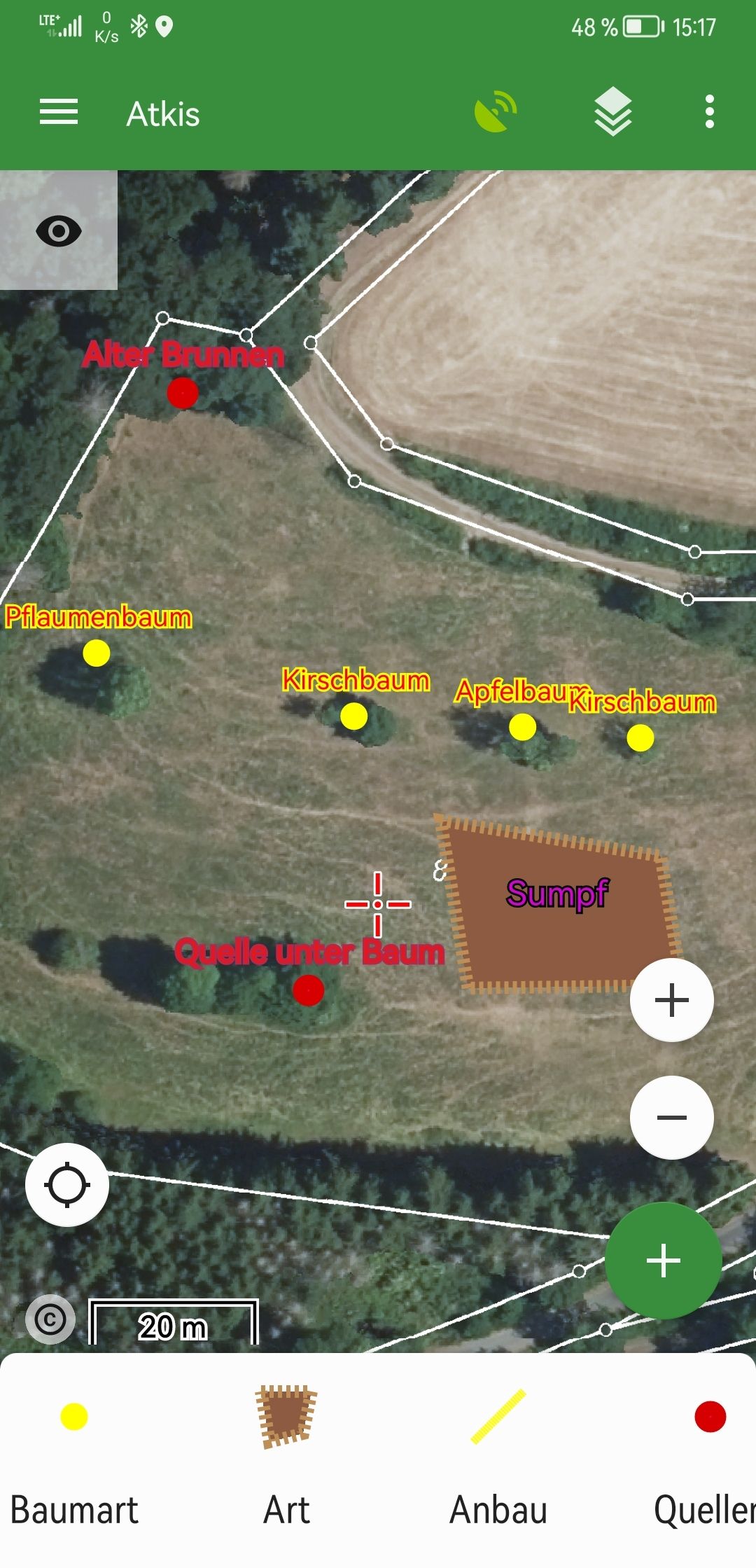
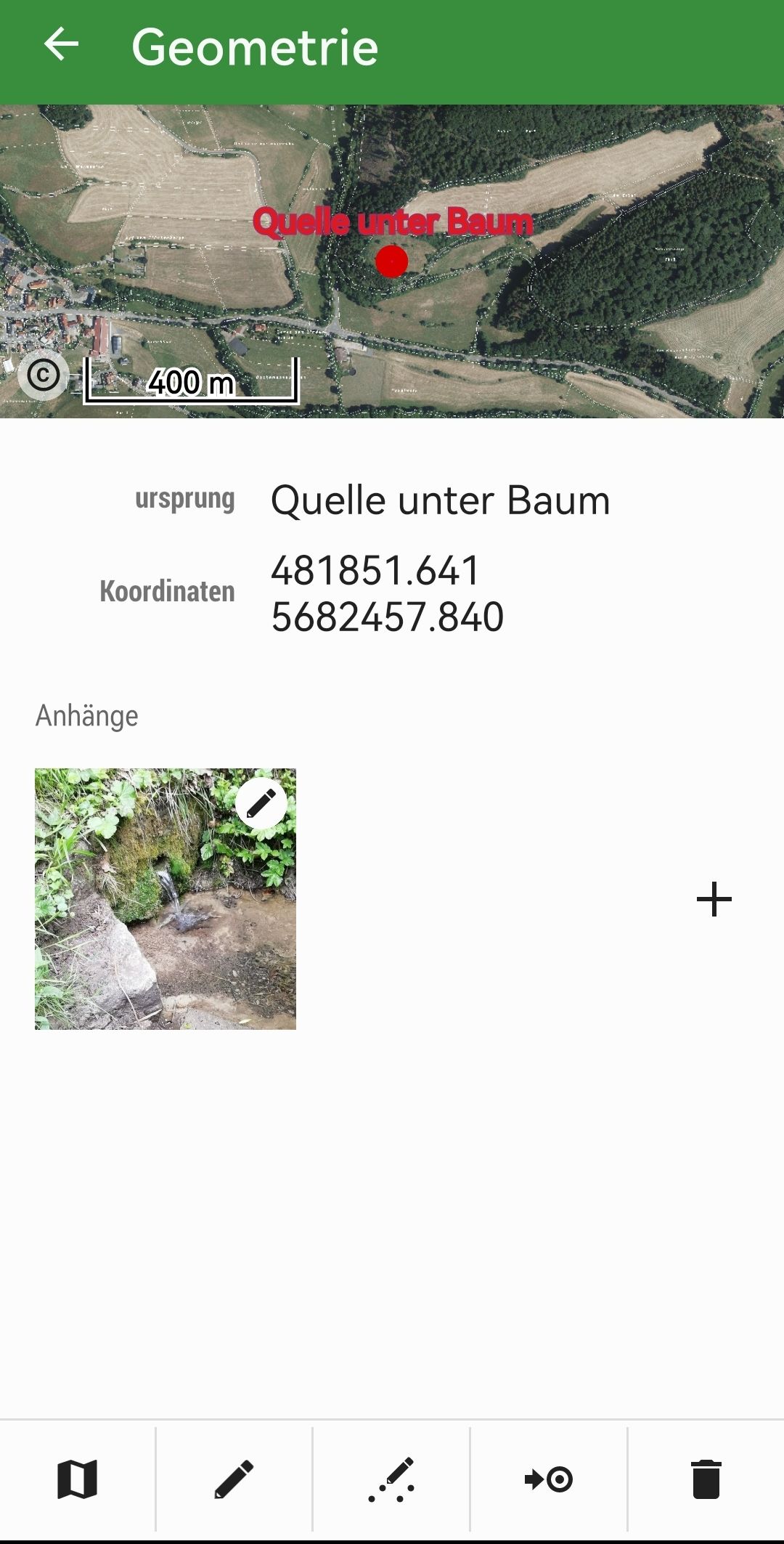
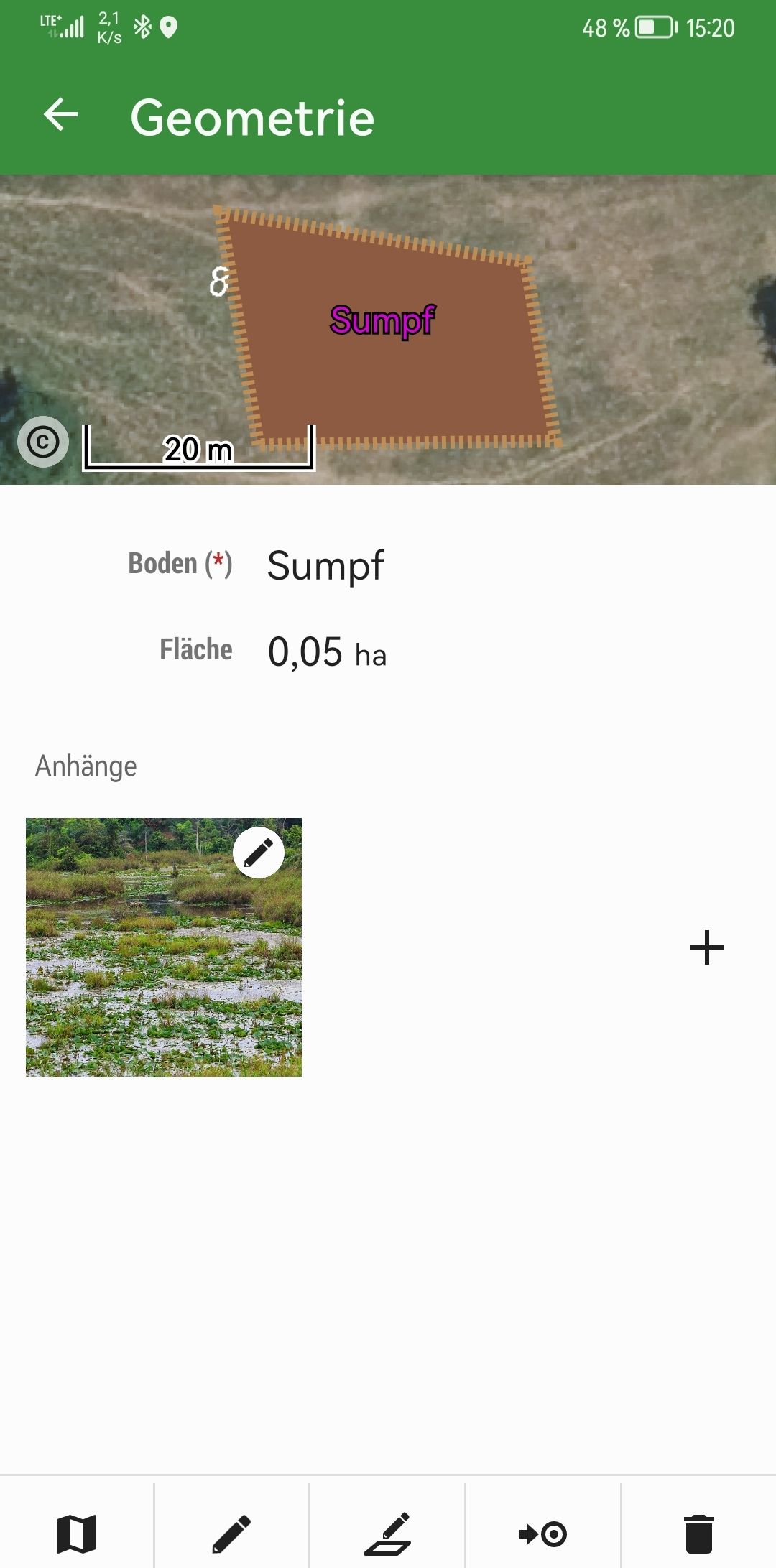
Reforestation and conservation efforts require accurate mapping of existing meadows. The Locus GIS application has proven to be an invaluable tool for this purpose.
The process starts with aerial photos, provided by the WMS Service Hessen, which provide a comprehensive overview with boundaries. However, these photos often lack the detailed information needed for effective mapping, such as the presence of swamps, springs, and specific tree populations and species.
To capture these details, a smartphone is used to conduct a field survey with an accuracy of about three meters. Field data is meticulously cataloged by object and determined in the field.
One of the key features of Locus GIS is the ability to export data directly from the field as shapefiles, which can then be sent to the office for further processing. This data is easily imported into GIS software such as QGIS for detailed analysis and application.
The app’s ability to save photos and edit objects greatly enhances the workflow, making subsequent tasks much easier. Overall, the efficient mapping provided by Locus GIS has saved considerable time in the reforestation planning process.
Meadow mapping in Locus GISMeadow mapping – springMeadow mapping – weatland
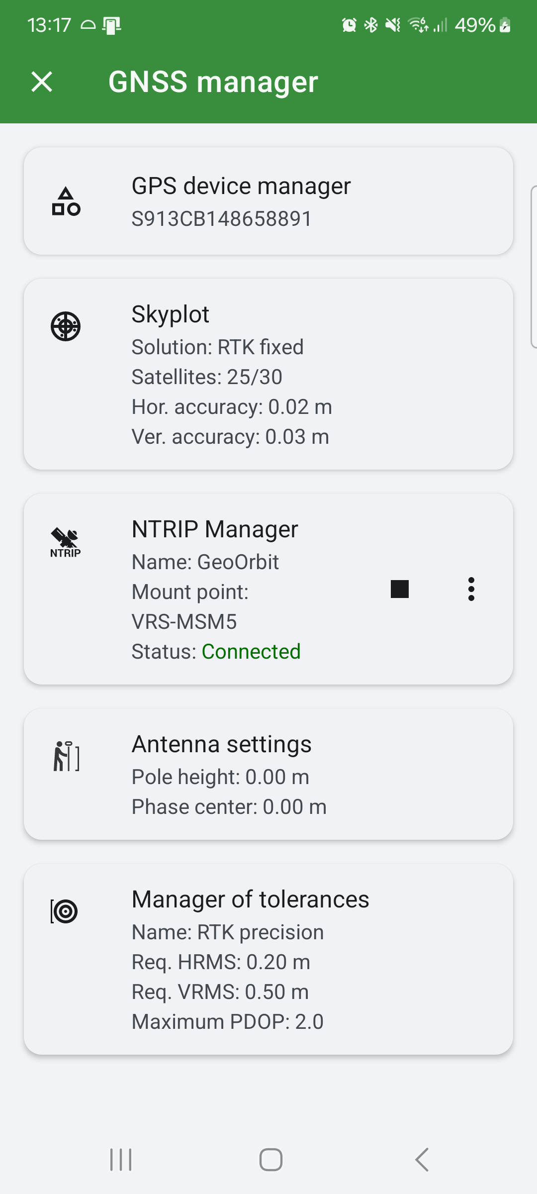
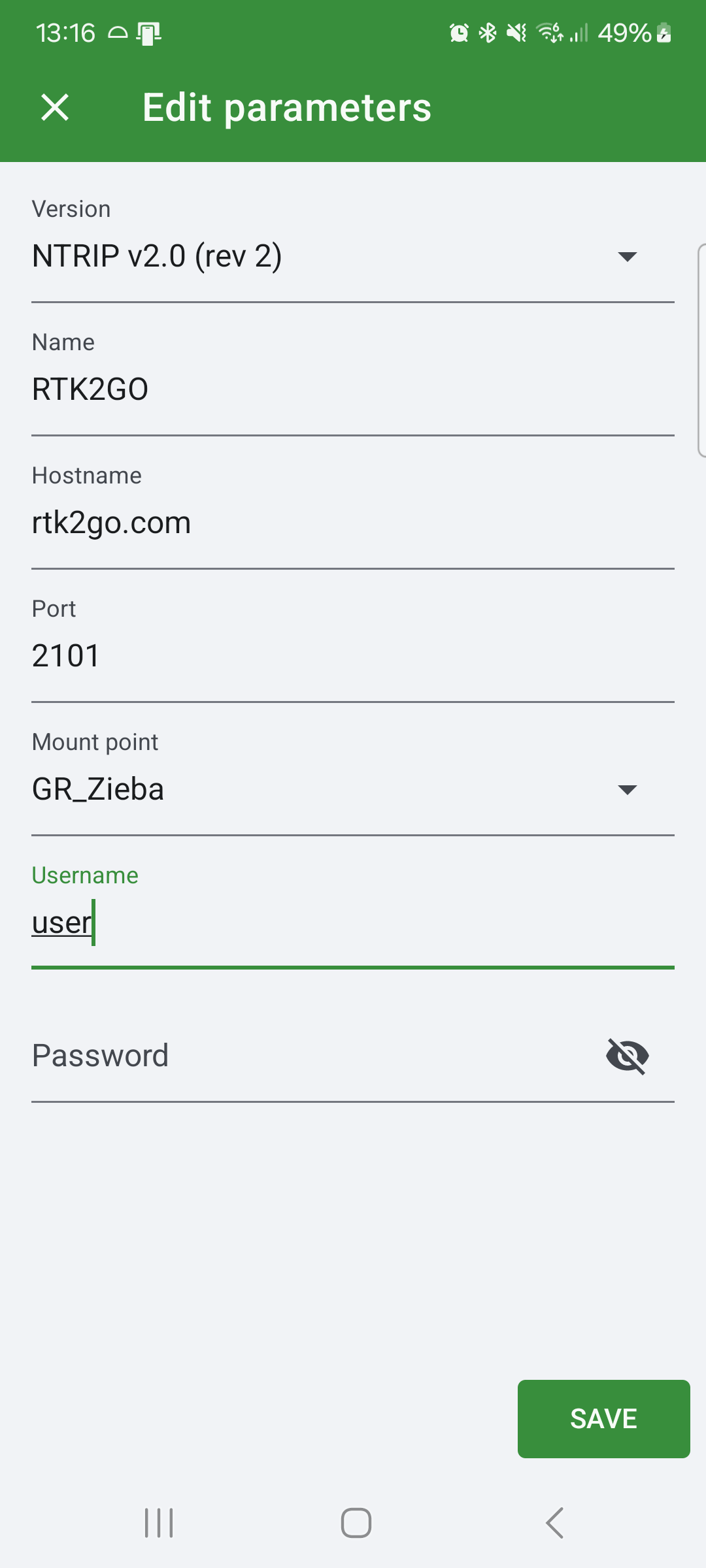
We are pleased to announce the latest version of our LocusGIS application, which includes a number of useful features for users who require high precision work. The new application offers the NTRIP client, which allows users to set tolerances (warning in case of insufficient accuracy) and also set the height of the datum. All important parameters related to GNSS setup can be found in the new GNSS manager.
NTRIP Client
NTRIP (Networked Transport of RTCM via Internet Protocol) is a protocol for the transmission of real-time GNSS corrections over the Internet. The NTRIP client enables the reception and implementation of this data in GNSS receivers, thereby significantly enhancing positional precision. The type of device in question will determine the level of accuracy achievable with the corrections in question, with centimeter accuracy in position and height being a possibility.
GNSS ManagerNTRIP Configuration
How does the NTRIP client work in LocusGIS?
The integration of the NTRIP client into our LocusGIS application provides users with the ability to receive real-time GNSS corrections without the need to use other applications. It is essential to use a Bluetooth GNSS antenna that supports correction processing. Additionally, it is necessary to establish a connection to an NTRIP server (caster) that provides real-time corrections in your area. The application establishes a connection to the NTRIP server, downloads the corrections, and provides them to the GNSS antenna, which then obtains the refined data.
Precise application usage for your needs
With NTRIP client support, the LocusGIS application is the ideal tool for anyone who needs to work with high accuracy positional data. Such as surveying, precision mapping, agriculture, construction, etc.
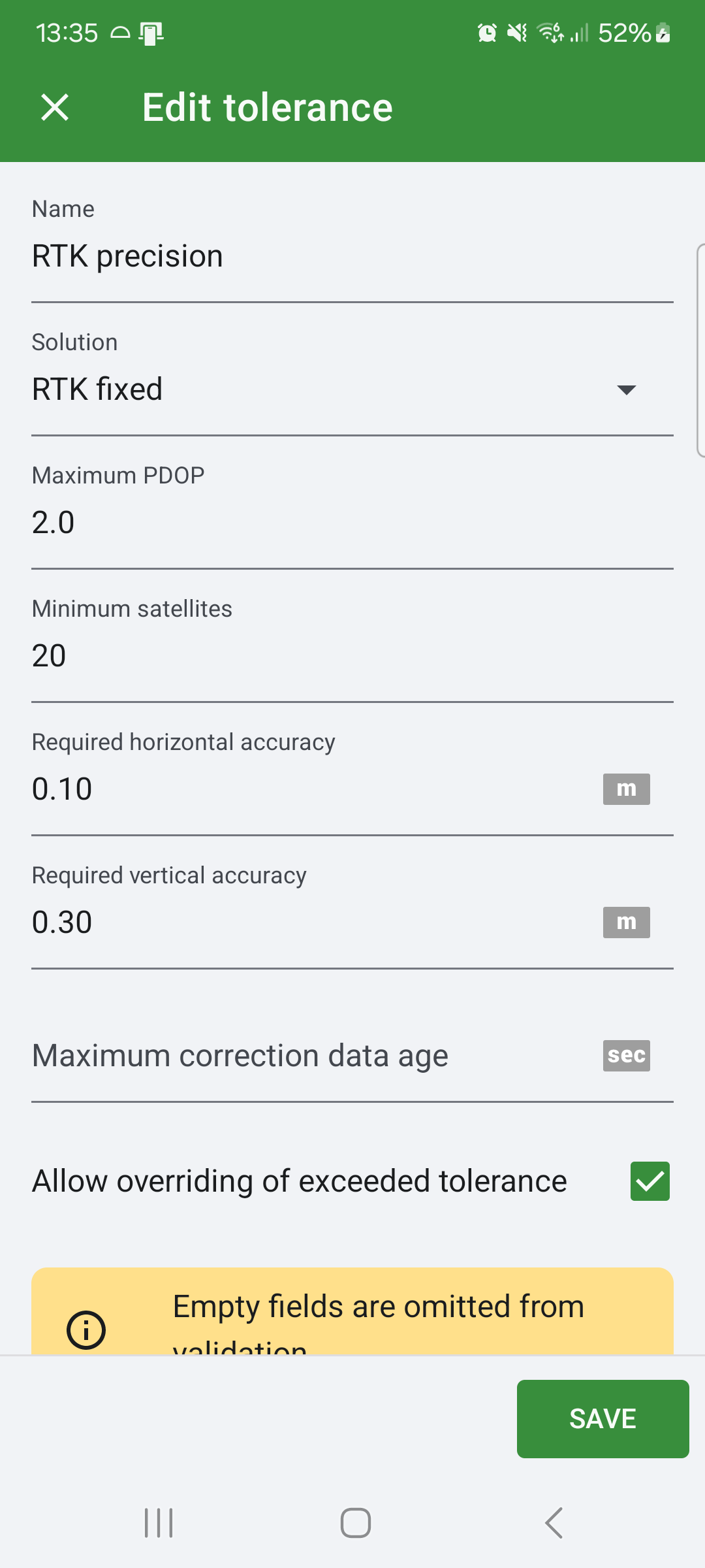
Tolerance manager
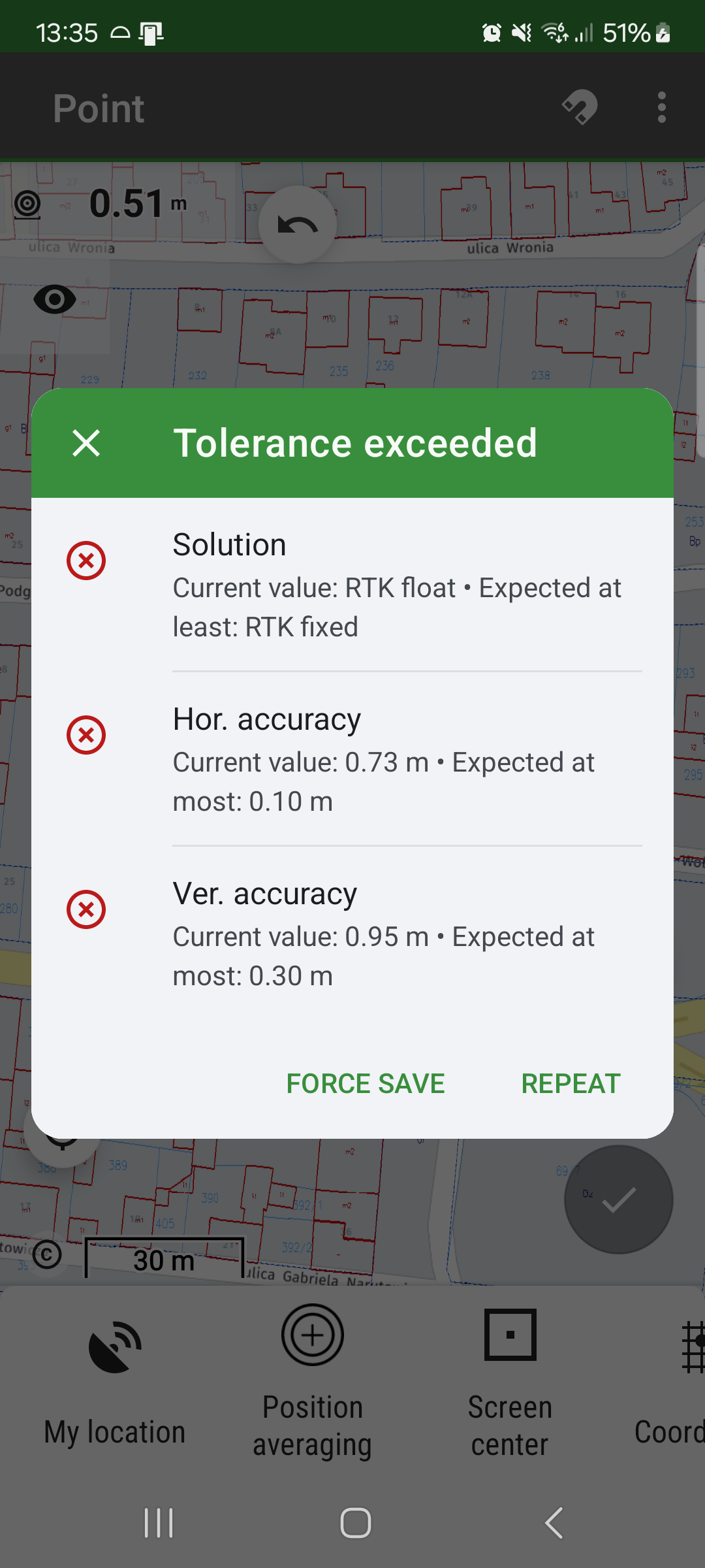
In addition to the NTRIP client, we have incorporated a new feature called Tolerance manager into the latest version. This feature enables users to specify the minimum required accuracy in position and height, the number of satellites used to obtain the position, the PDOP (Position Dilution of Precision) value, and the solution. Upon saving a new point, the application verifies the set tolerances. If any of these tolerances are not met, the application displays a warning dialog to inform the user about the lack of accuracy. The user has the option of reacquiring the position or saving the point despite the lack of precision, should they wish to do so. This feature provides users with greater control and confidence in their data acquisition.
Tolerance warning
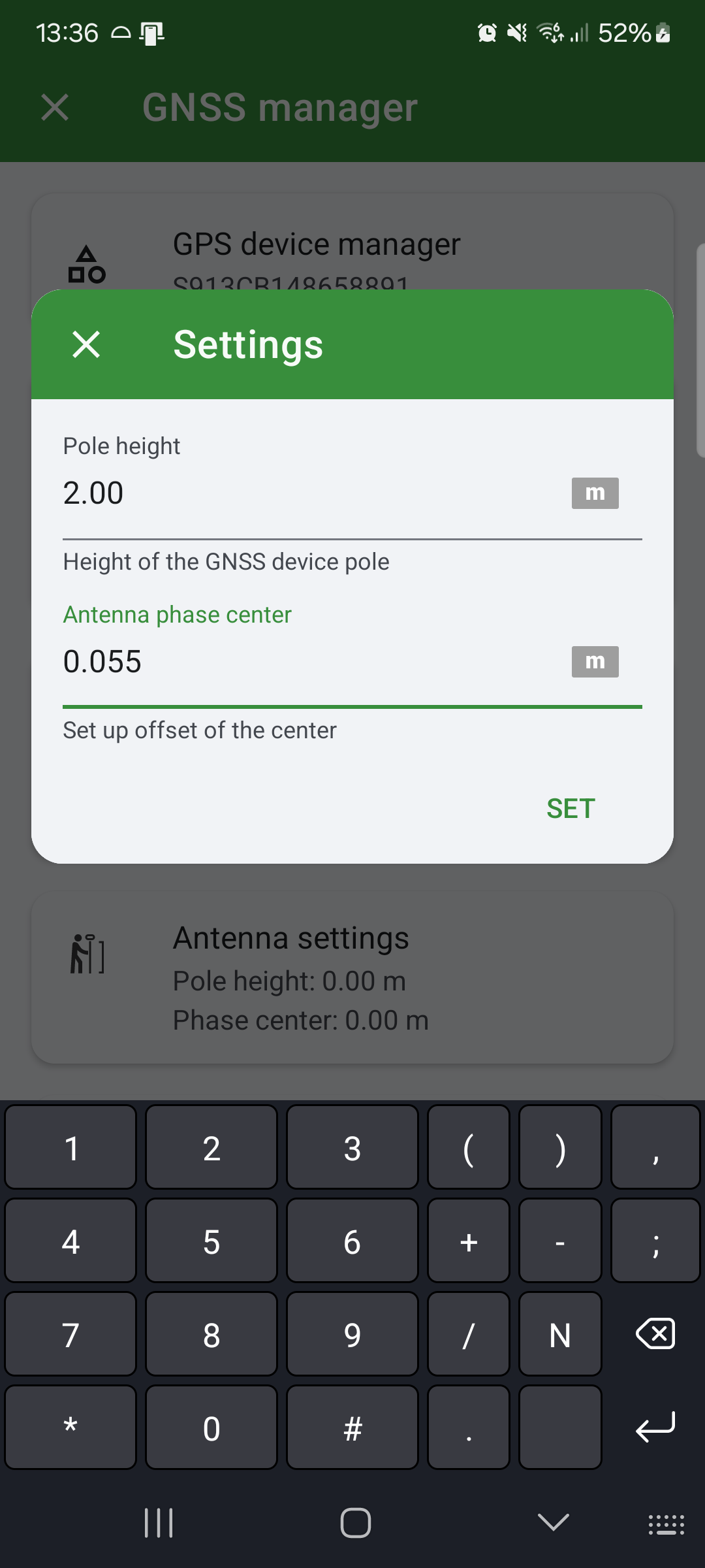
Adjusting the height of the pole and phase centre
When working with a precision GNSS antenna, it is of the utmost importance to ensure that the height of the pole is correct. This feature allows users to set the pole height and phase center, which is beneficial for those who require this functionality. The application automatically corrects the measured elevation based on these values.
Set pole height
We are confident that the Locus GIS 1.22, which includes a built-in NTRIP client and tolerance manager, will assist you in achieving greater accuracy and precision in your work, thereby enabling you to reach new heights in your performance goals and improve your overall work effectiveness.