Locus GIS Now Supports GLRM Device
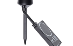
We are pleased to announce that Locus GIS now seamlessly integrates with the GLRM RTK GNSS […]
mehr
We are pleased to announce that Locus GIS now seamlessly integrates with the GLRM RTK GNSS […]
mehr
In the ever-evolving world of geospatial technology, precision is paramount. That’s why we’d like to highlight […]
mehr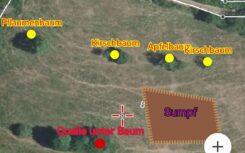
Reforestation and conservation efforts require accurate mapping of existing meadows. The Locus GIS application has proven […]
mehr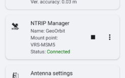
We are pleased to announce the latest version of our LocusGIS application, which includes a number […]
mehr
Leider ist der Eintrag nur auf English verfügbar.
mehr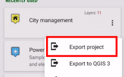
Die brandneue Version von Locus GIS, die soeben unsere Entwicklungsumgebung verlassen hat, bringt einige wesentliche Verbesserungen […]
mehr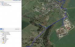
Wir haben Sie nicht darüber informiert, was wir in den letzten Monaten bei Locus GIS verbessert […]
mehr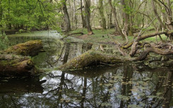
Wir haben schon oft erwähnt dass Locus GIS ein sehr vielseitiges Hilfsmittel ist. Geodatenerfassung wird in […]
mehr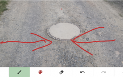
Sie arbeiten bei Ihren Projekten mit Layern aus Landkarten und Geodaten. Das Erfassen der Daten erfordert […]
mehr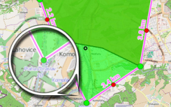
Leider ist der Eintrag nur auf Čeština und English verfügbar.
mehr