Locus GIS Now Supports GLRM Device
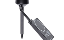
We are pleased to announce that Locus GIS now seamlessly integrates with the GLRM RTK GNSS […]
více
We are pleased to announce that Locus GIS now seamlessly integrates with the GLRM RTK GNSS […]
více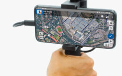
In the ever-evolving world of geospatial technology, precision is paramount. That’s why we’d like to highlight […]
více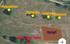
Reforestation and conservation efforts require accurate mapping of existing meadows. The Locus GIS application has proven […]
více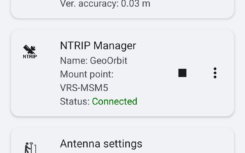
We are pleased to announce the latest version of our LocusGIS application, which includes a number […]
více
Nedostupné
více
Zbrusu nová verze aplikace Locus GIS, která právě opustila naše vývojářské pracoviště, přináší několik zásadních vylepšení. […]
více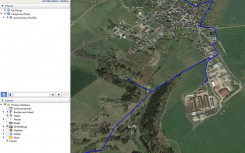
Dlouho jsme se nepochlubili, co všechno jsme v Locusu GIS za poslední měsíce vylepšili. Přinášíme vám […]
více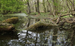
Že je Locus GIS univerzální pomocník, jsme již mnohokrát zdůrazňovali. Sběr geodat je totiž potřebný v […]
více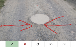
Vaše projekty pracují s vrstvami map a geodat. Sběr dat vyžaduje precizní práci s atributy sbíraných […]
více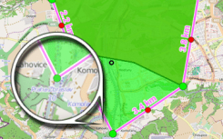
Locus GIS is an Android application for users which need to work with geospatial data on […]
více